
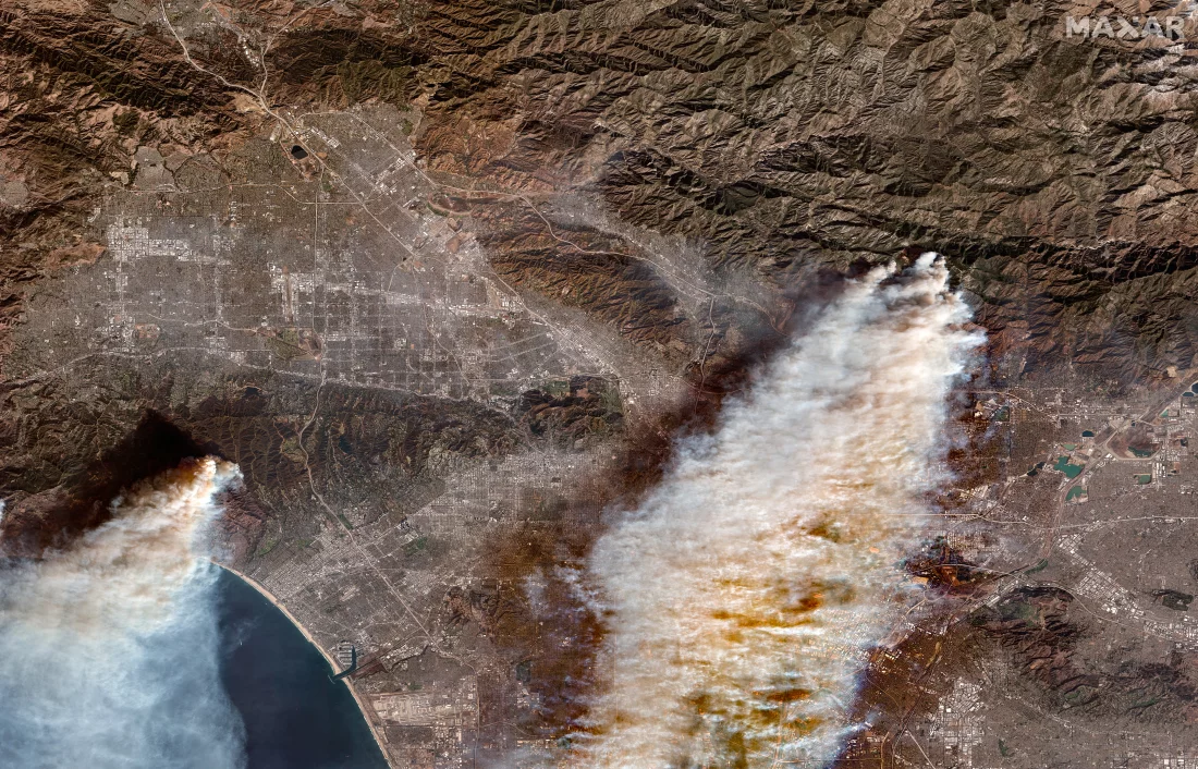
Los incendios que se propagan rápidamente están dejando rastros de destrucción en el área de Los Ángeles, matando al menos a 10 personas , hiriendo a muchas más y destruyendo cientos de hogares y negocios. Las imágenes satelitales de Maxar Technologies muestran hogares y negocios antes de que comenzaran los incendios y el resultado carbonizado que quedó después.
Fast-moving fires are blazing trails of destruction in the Los Angeles area, killing at least 10 people, injuring many more, and destroying hundreds of homes and businesses. Satellite images by Maxar Technologies show homes and businesses before the fires started and the charred aftermath.
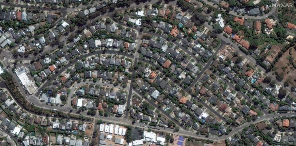
The Palisades fire has burned more than 19,000 acres, including extensive damage to homes and other buildings in the Pacific Palisades neighborhood (above) — some of which continue to smolder.

The image above shows the Palisades fire’s destruction along the Pacific Coast Highway. The fire has also damaged landmarks across Los Angeles County, including some vegetation and trees on the site of the Getty Villa, a Greco-Roman art museum on the highway.
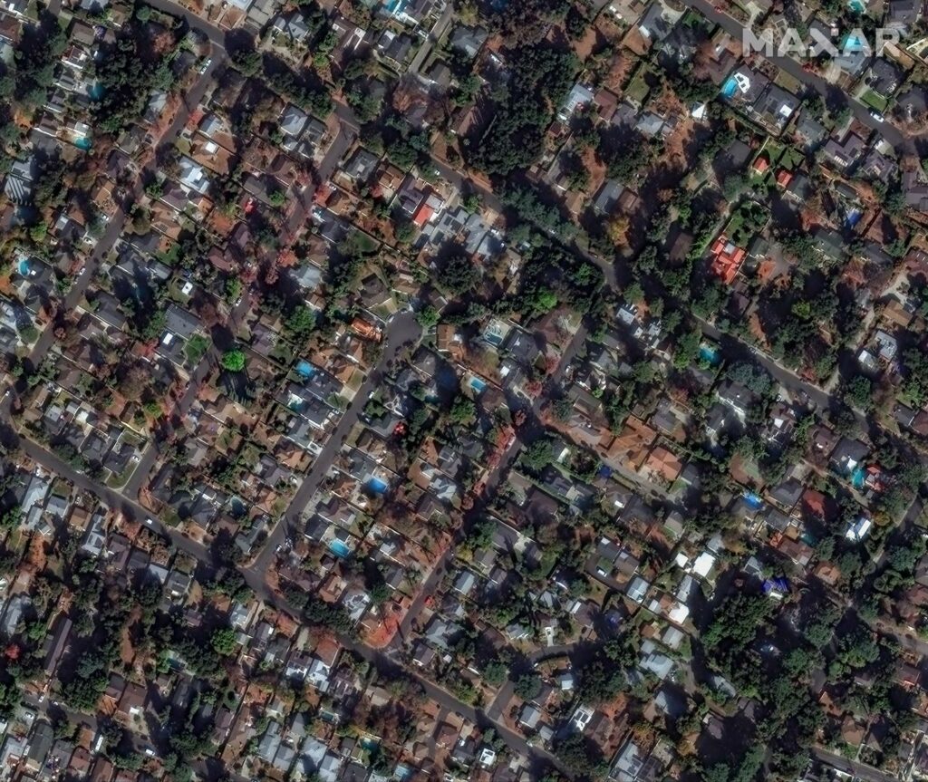
In the image from Wednesday, the remains of homes in Altadena, Calif., near Marathon Road are seen from space after the Eaton fire blazed through the area. The Eaton fire has destroyed more than 13,000 acres, including parts of Altadena, north of Pasadena, an area bordering the Angeles National Forest.
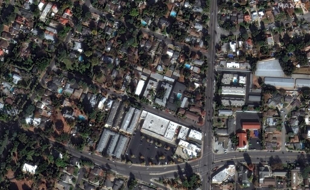
Homes and businesses along Altadena Drive are seen burning in the image from Wednesday.
Fuente: https://www.npr.org