
Con temores siempre presentes de que Israel pueda lanzar una invasión terrestre contra Hezbollah en el Líbano, los datos sugieren que los casos de interferencia de GPS en la nación han alcanzado niveles sin precedentes en las últimas semanas, lo que provocó protestas diplomáticas en Beirut por la amenaza a la aviación civil. La interferencia, probablemente esté relacionada con el esfuerzo de Israel para interrumpir los ataques de Hezbollah en el norte de Israel.
BEIRUT — With ever-present fears that Israel could launch a ground invasion against Hezbollah in Lebanon, data suggests instances of GPS jamming in the nation have spread markedly in recent weeks, sparking at diplomatic protest by Beirut over the threat to civil aviation.
The jamming, experts told Breaking Defense, is likely related to Israel’s effort to disrupt Hezbollah attacks on nothern Israel.
“Many bombs, drones, and other weapons use GNSS [global navigation satellite systems] for guidance these days, which makes them much more accurate and easier to manufacture than trying to build accurate INS [inertial navigation systems],” said Brian Weeden, head of program planning at the Secure World Foundation. “So interfering with GNSS signals is seen as a prudent defensive move.”
The head of global and emerging risks at the Geneva Center for Security Policy, Jean Marc Rickli, agreed that especially when it comes to the proliferation of unmanned aerial vehicles, “one of the best ways to counter them is to jam their communication systems by cutting the link between them and the operator or the GPS [Global Positioning System] signal.”
GPS, the US-developed GNSS system, is the most prevelant worldwide; a handful of systems developed by other nations are also in use.
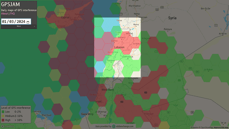
While Israel has reportedly aggressively jammed its adversaries in the region since the outbreak of the most recent conflict in October, the website GPSJam.org, which maps purported GNSS interference based on publicly broadcasted aircraft data, appears to show an geographical increase in interference over Lebanon in recent weeks. As of publication there appears to be interference covering most of the southern half of the country.
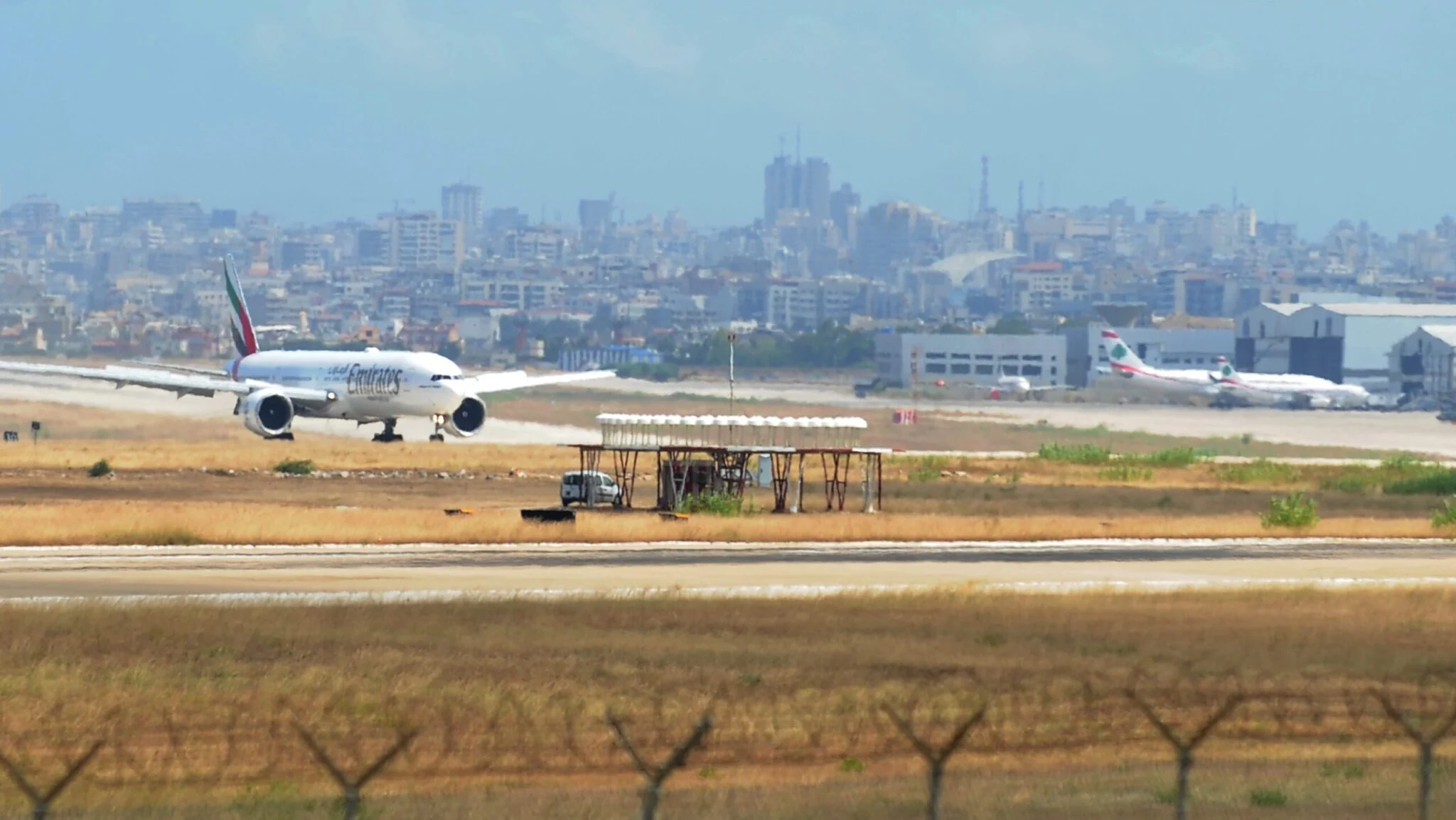
The interference was so bad that last week a Turkish airlines flight reportedly was unable to land in Beirut and was forced to return to its origin in Turkey. (It’s also apparently interfering with dating apps in Lebanon and Beirut.)
That incident came days after the Lebanese government announced its intention to file a complaint at the United Nations accusing Israel of disrupting civil aviation navigation systems.
“Lebanon plans to urgently present its complaint to the UN Security Council regarding Israel’s interference with navigation systems and civil aviation safety since the onset of the Gaza conflict,” the Lebanese foreign ministry said last month.
Lebanon is hardly alone, however, as Weeden noted there’s been a marked rise in GNSS jamming related to other ongoing modern conflicts.
“We are seeing it happen also in the ongoing conflicts in Syria and Ukraine, and also increasingly out of conflict as well,” he said. “At one point in January 2024, there was significant GNSS jamming or spoofing affecting civil aviation in eight different countries or regions. And unfortunately, because the rest of society has become so reliant on GNSS, this jamming and spoofing is having widespread impacts.”
Alternative Navigation Systems
Weeden said that when planes encounter GNSS interference, there are still ways for pilots to navigate safely to their destination.
“Several [systems] use radio signals in various ways to provide fixed navigational reference points, while others provide dedicated services at airports to aid in landings. Many aircraft also still have inertial navigation systems (INS), which are mechanical devices that are set before takeoff and can maintain a position somewhat during flight,” he explained.
Inertial navigation systems keep track of position, speed, altitude and other data without the need to use radio signals or GPS.
Deputy director of aerospace security project at the Center for Strategic and International Studies CSIS, Clayton Swope, said that there is another aircraft navigation backup: Very High-Frequency Omnidirectional Range Station or VOR, a radio-based navigation system.
“VOR is viewed as a backup to GPS for aircraft navigation. But VOR stations are being decommissioned, since they are expensive to operate,” Swope told Breaking Defense. “Overall, the idea is to build in a lot of redundancies, so that if one navigation system is disrupted, there are other backup ways to get the airplane safely to its destination.”
But Weeden said modern aviation has come to increasingly default to using GNSS, making it more dangerous to rely on other systems.
“Over the last 20 years or so is that the ubiquity of GNSS, and especially GPS, has led to increased reliance on it for navigation and a deprioritization of the other technologies. Many still exist, but they aren’t used or trained on as often,” Weeden said. “There’s also some evidence to suggest that a corrupt GNSS position can corrupt these other backups, which is a very bad situation.”
And it’s a problem that’s unlikely to disappear any time soon, as Israel and Hezbollah trade aerial attacks daily.
“While there are backup navigational technologies, efforts to undermine GPS … pose public safety risks,” Swope said. “Aircraft can still operate without GPS, but efforts to interfere with GPS could erode trust and confidence in the data, calling into question whether it can be viewed as a reliable navigation source in all places around the world.”
EDITOR’S NOTE 4/2/2024 at 12:55pm ET: This report has been updated to clarify the geographical spread of the jamming based on a Breaking Defense analysis of data from GPSJam.org and to include a gif of the purported interference over time.
Fuente: https://breakingdefense.com