
La compañía estadounidense Near Space Labs ha instalado la primera red de vigilancia estratosférica, utilizando su sistema de obtención de imágenes de ultra alta resolución, montados en los robots SWIFT de esa compañía. La plataforma que soporta el sistema robotizado, son globos aerostáticos que operan entre 20.000 y 28.000 m, que permiten obtener imágenes de una zona de hasta 1.000 km2, con una resolución de 7 cm. Por sus características y bajo costo relativo, constituye una formidable herramienta de empleo civil para planificadores urbanos, sistemas de emergencia, agencias gubernamentales, etc, pero además con múltiples aplicaciones posibles de empleo militar.
Near Space Labs, a startup based in Brooklyn, New York, has achieved a significant milestone with the nationwide deployment of its Swift robots across the United States.
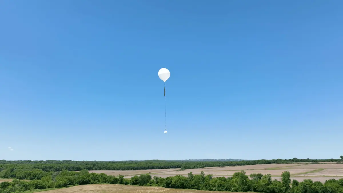
This accomplishment marks the establishment of the first network of stratospheric robots delivering ultra-high-resolution aerial imagery throughout the continental US.
The Swift robots now offer enhanced resolution capabilities of 7 centimeters, which match or surpass traditional aerial survey quality.
The Swift is a zero-emission robot that can capture up to 1,000 square kilometers of imagery in a single flight—an area equivalent to the combined size of New York City’s five boroughs
Operating at altitudes between 60,000 and 85,000 feet, this compact 12-pound autonomous system provides insurance companies, urban planners, and government agencies with unprecedented access to highly detailed and frequently updated aerial imagery, all at a fraction of the cost of traditional methods.
First-ever deployment
Near Space Labs’ nationwide expansion and improvements in imaging are crucial for the US home insurance industry.
In 2023, the industry experienced its worst crisis in decades, with net combined ratios exceeding 110 percent and losses surpassing $101 billion.
These results are largely driven by the increased frequency and severity of weather events, including devastating hurricanes, tornadoes, and catastrophic wildfires.
Consequently, major insurance companies are withdrawing from high-risk states such as Florida, California, and Texas, threatening homeownership and regional economies.
The root of this crisis is the growing gap between escalating climate risks and insurers’ ability to assess them accurately.
“Many insurance companies are still relying on aerial data collection methods from the 1950s to assess 2024’s climate risks,” said Rema Matevosyan, CEO of Near Space Labs.
“When you consider that only six percent of the $250 billion in losses from Hurricane Helene may be covered by insurance, it becomes clear that outdated risk assessment methods are creating a domino effect: poor data leads to inadequate policy pricing, which leads to carrier losses, which ultimately forces insurers to abandon entire markets—leaving homeowners stranded and unable to secure mortgages.”
Autonomous robots
Near Space Labs is launching a nationwide deployment of top-quality imaging capabilities to address a significant challenge for insurance carriers. This initiative will provide detailed, up-to-date property data every quarter.
The unprecedented frequency of these updates allows insurers to monitor changing conditions, assess risks more accurately, and price policies appropriately. This could enable them to re-enter markets they previously abandoned.
This rollout marks the first-ever nationwide deployment of ultra-high-resolution aerial imagery at scale, surpassing all existing commercial options such as satellites, drones, and airplanes.
With this initiative and the backing of Fortune 500 insurers, Near Space aims to tackle America’s home insurance crisis. This crisis is exacerbated by inadequate data that leads to substantial losses and market exit.
“With our balloons and our Swifts, insurance companies are able to get access to information right after the catastrophe and assess the damage and pay out claims within days instead of weeks and months,” said Matevosyan.
The giant weather balloons ascend to altitudes twice as high as those of cruising airplanes. According to the company, the cameras deliver high-resolution imagery across thousands of square miles.
“Our balloons capture what 800,000 drones would with one flight,” Matevosyan said.
“An airplane would be flying in a snake like pattern, back and forth, back and forth for weeks to capture the data that we can capture within hours. This means that we can be faster, better and cheaper for our customers.