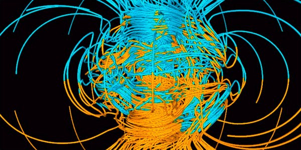
El WMM es un producto realizado por la Agencia Nacional de Inteligencia Geoespacial (NGA) de los Estados Unidos y el Centro Geográfico de Defensa (DGC) del Reino Unido. El WMM fue desarrollado conjuntamente por los Centros Nacionales de Información Ambiental (NCEI, Boulder CO, EE.UU.) y el British Geological Survey (BGS, Edimburgo, Escocia). El WMM es el modelo estándar utilizado por el Departamento de Defensa de los Estados Unidos, el Ministerio de Defensa del Reino Unido, la Organización del Tratado del Atlántico Norte (OTAN) y la Organización Hidrográfica Internacional (OHI), para la navegación, la actitud y los sistemas de referencia de encabezados utilizando el campo geomagnético. También se utiliza ampliamente en los sistemas de navegación civil y rumbo. El modelo, el software asociado y la documentación son distribuidos por NCEI en nombre de NGA. El modelo se produce cada 5 años. (el actual expira el 31 de diciembre de 2024).
Navigation
Compasses have been used for several thousand years to determine direction. They point in the direction of magnetic force at the user’s location, and the direction it points is, more often than not, in a different direction than geographic north (toward the North Pole), a more precise direction is achieved by knowing the angle between them (magnetic declination). However, declination changes with location and time, and a geomagnetic model is often used to correct for it. Since the changes in geomagnetic fields are difficult to predict, timely model updates (every 5 years for the WMM) are required for navigational accuracy. The WMM satisfies all these criteria and is therefore widely used in navigation. Examples include, but are not limited to, ships, aircraft and submarines. Magnetometer based attitude (roll and pitch) control is commonly used in aircraft and satellites.
GPS
Why do we need magnetic navigation when Global Position System (GPS) is readily available? GPS provides precise point location but only measures travel direction when in constant motion. A GPS receiver must collect several sets of latitude and longitude pairs to obtain direction. In addition, GPS signals may become blocked due to obstructions, adverse terrestrial and space weather, ionospheric conditions or being underwater or underground. Hence, compasses complement GPS receivers to attain precise and immediate navigational headings for air, ground, and water-based systems. Electronic compasses and the WMM commonly co-exist in GPS receivers.
Antennas and Solar Panels
Antennas (e.g. satellite dish television) and solar panels often need to be precisely oriented for maximum performance. The WMM’s declination information for specific locations is often employed by companies to orient their products correctly.
Consumer Electronics
While the traditional use of the WMM is for navigation, it is now acquiring new utilities in consumer electronic devices with built-in digital compasses. Many of the new generations of smart phones and digital cameras take advantage of the WMM to estimate bearing. The availability of low-cost, small, and energy efficient electronic compasses allow for magnetic direction in portable electronics to be common place. NOAA is providing support to application development engineers to port WMM to their devices. For example, WMM comes pre-installed in Android and iOS devices, thereby bringing its use to more than a billion devices around the world. NOAA/NCEI has developed an application called CrowdMag that allows users to collect their own magnetic field data using the magnetometers in their phone. This app sends data anonymously back to NOAA so it can be used to help validate and expand future magnetic models.
Mineral Exploration
Airborne and marine magnetic surveys are used by oil and mineral exploration companies to detect magnetic signals from the Earth’s crust. These small amplitude signals (typically 100s of nT), must be separated from the large main magnetic field (typically 20,000 to 60,000 nT). Geomagnetic models are used by companies to extract these small magnetic signals from the survey records. A new application is the use of geomagnetic models for directional drilling. Oil wells are often drilled horizontally from a conveniently located platform. An electronic compass located behind the drill head (bit) provides the engineers with accurate orientation of the bit.
Fuente: https://www.ngdc.noaa.gov


